Northern Izu
-
The Kakita River is designated as a national monument.
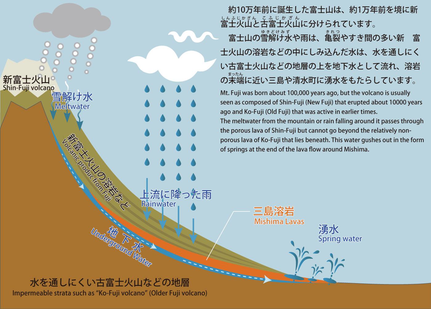
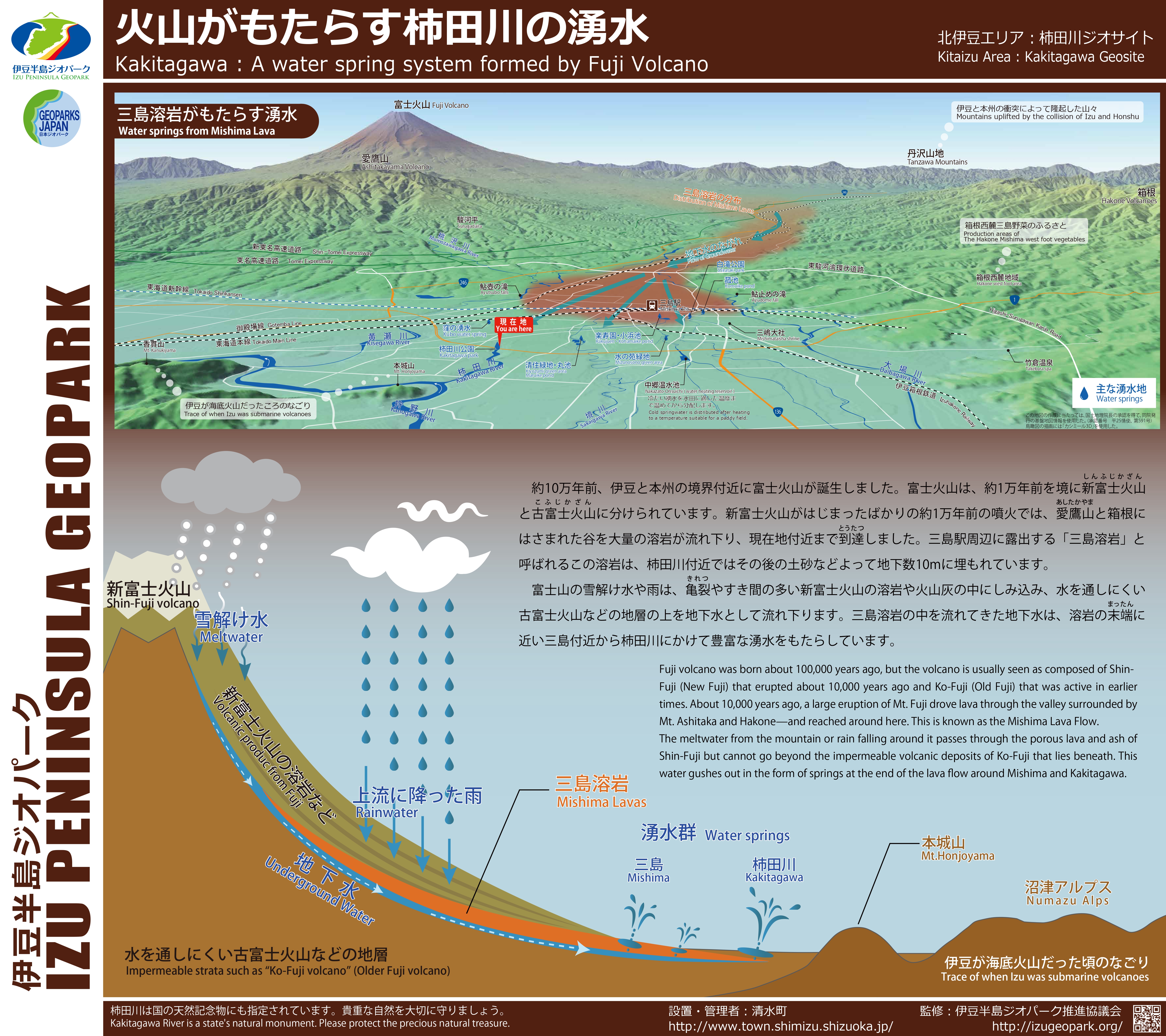
About 10,000 years ago, lava erupted from Mt. Fuji flowed through the valley surrounded by Mt. Ashitaka and Mt. Hakone and reached around here. Meltwater and rainwater around Mt. Fuji flow through this porous lava and gush out from the underground.
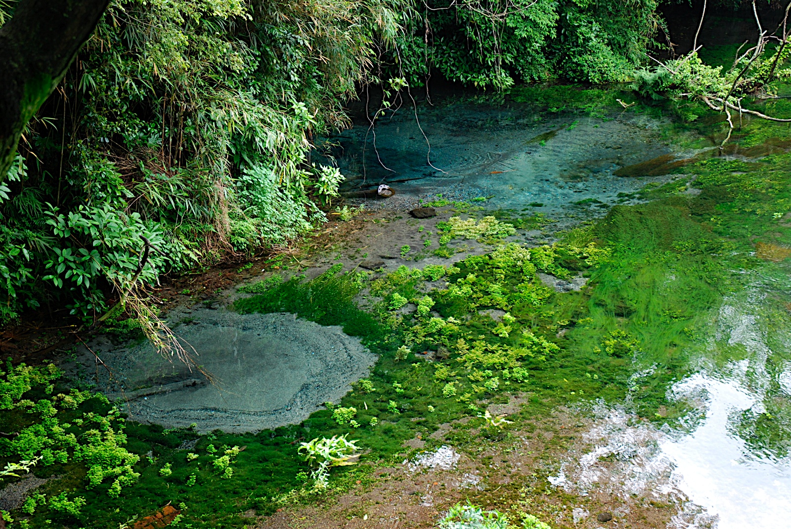
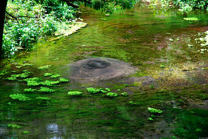
On the riverbed of the Kakita River, there are many places where springs well up. Looking closely at these springs, you see tiny white pebbles coming up and down. These pebbles were produced at a volcanic event around 3200 years ago and well up together with groundwater.
***
The Kakita River is a spring-fed river that makes up a unique ecosystem.
Spring-fed rivers are characterized by the stable environment. The water temperature of the Kakita River remains around 15 degrees Celsius throughout the year, so it is cool in summer and warm in winter. You can see living creatures at different timings than at other rivers, including the observation of dragonflies in wintertime. Combined with good water quality, fauna and flora that are endangered today inhabit the stable riverbed of the Kakita River.
In addition, sediments from Mt. Fuji are used as the spawning ground of sweetfish. Even after the breeding season, it sometimes survives the winter due to the warm temperature of the Kakita River. 
The water quality of the Kakita River was once deteriorated due to industrial wastewater.
Local communities have played a significant role in the restoration of the environment. The spring water provides drinking water for the surrounding area.
Local communities have played a significant role in the restoration of the environment. The spring water provides drinking water for the surrounding area.
![]() Basic information
Basic information
- Travel information
-
・Tourist information center (Japanese only)(external link)
- Safety information
- Access
-
By public transportation: 15 minutes by bus from JR Mishima Station (bus stop name: Kakitagawa Yusui Koen Mae)
By car: 15 minutes from Numazu Interchange (SHIN-TOMEI EXPWY)
- Rest room
- Kiosk & Rest houses
- Parking information
- Paid parking
![]() Neighboring sites of [ Kakita River ]
Neighboring sites of [ Kakita River ]
![]() Related sites of [ Northern Izu ]
Related sites of [ Northern Izu ]
-
Komoike pond and Shiratakikoen park
・Northern Izu
・Geosite
・Moving Earth
・Natural spring&Hot spring
-
Rakujuen Genbeegawa
・Northern Izu
・Geosite
・Culture&History
・Moving Earth
・Key site
・Natural spring&Hot spring
-
Kuchino (path cut open through submarine volcanic deposit)
・Northern Izu
・Geosite
・Culture&History
・Submarine Volcano
・Strata
- Choose from categories
- Choose from geology
- Choose from landforms
- Choose from regions
- Choose from sites


.jpg)


