Northern Izu
-
Spring water
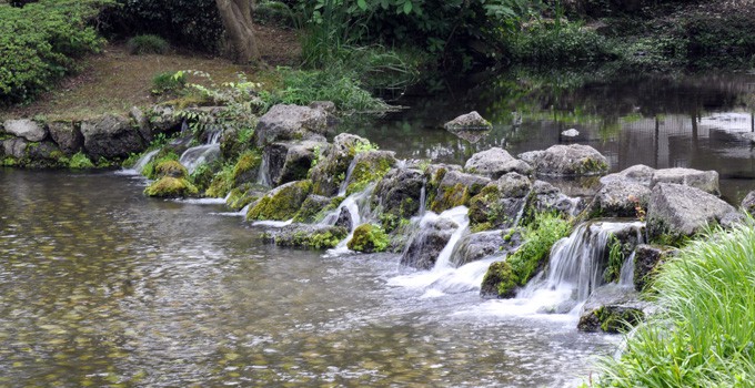
Lava of Mishima, which flowed out during the volcanic eruption of Mt. Fuji of about 10,000 years ago has formed a large portion of the ground of the city area caught between the two rivers of the area: Kise and Daiba.
The ground water flowing through the crevices inside of this lava flow gush out in various places all around Mishima city, for example in Komo and Kohama ponds located on the premises of Rakujuen Park (a place of scenic beauty designated by the government as national natural monument), forming the distinctive streetscape and culture of the city with its many brooks such as Genbei.
The surface of lava flow in Rakujuen offers a magnificent view of its structure resembling a labyrinth of interwoven ropes.
![]() Basic information
Basic information
- Travel information
- Safety information
- Access
- 5 minutes walk from JR Mishima Station(Rakujuen)
- Rest room
- Kiosk & Rest houses
- Parking information
- Visitors by car can use the parking lot of the Rakujuen.
![]() Neighboring sites of [ Komoike pond and Shiratakikoen park ]
Neighboring sites of [ Komoike pond and Shiratakikoen park ]
![]() Related sites of [ Culture & History ]
Related sites of [ Culture & History ]
-
Omuroyama Volcano
・Eastern Izu
・Geosite
・Biodiversity
・Culture&History
・Izu Tobu Volcanos
・Moving Earth
・Living with the Earth
・Key site
・Lookout
・Volcanic crater
-
Hashiriyu
・Northern Izu
・Geosite
・Culture&History
・Moving Earth
・Natural spring&Hot spring
-
Atami Town
・Northern Izu
・Culture&History
・Large Terrestrial Volcano
・Living with the Earth
・Natural spring&Hot spring
-
Senganmon Rocks
・Western Izu
・Geosite
・Culture&History
・Submarine Volcano
- Related sites
- Choose from categories
- Choose from geology
- Choose from landforms
- Choose from regions
- Choose from sites


